CorText Manager has some tools to explore geographical dynamics :
- Geocode addresses and enrich corpus with a geographical layer of information (city names, region names, longitude and latitude coordinates);
- GeoEdit to refine geocoded locations
- Geospatial exploration tool to explore the geographical distribution of your dataset across Urban and Rural Areas, NUTS and other spatial units.
Spatial processing documentation
Geocode your addresses and enrich your dataset with geographical information
In digitalized documents, especially those with texts, more than 70% contains geographical information. Nevertheless, a large proportion of this information are not formalized to be projected and manipulated on maps, and there are stored in various forms (Hill, 2006): pictures of places, toponyms in full text documents, addresses, structured metadata or, finally, geographical coordinates. Adding...
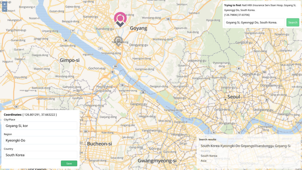
GeoEdit: refine geocoded locations
Geocoding an address or a toponym is a complex process. Locations across the world are extremely ambiguous and addresses may contain information that are not related to space. But when feeding a research work: quality is crucial! To help you to increase the accuracy of the geocoded information, we have developed GeoEdit tool to refine...
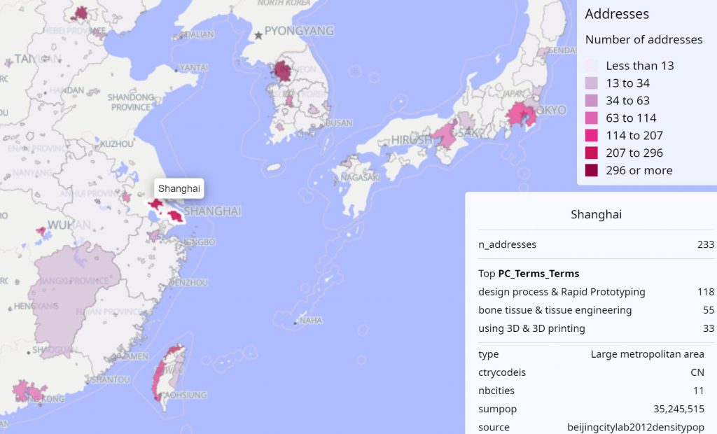
Visualise and explore the geographical distribution of your dataset across urban and rural areas
Geographical phenomena are by nature distributed. To deliver geographical coordinate to an address is one thing, but for the purpose of spatial analysis it is often necessary to aggregate geographical information, and associated data, on a more suitable scale. It is the case, for example, for analysing inter-urban or regional spatial dynamics based on human...
Latest questions in the Q&A forum on spatial processing
2431 views3 answers0 votes
 Cortext Manager Documentation